Topographic Survey
Measured land survey to engineering tolerance — levels, contours, boundaries and surface features captured to OSGB36 and delivered as CAD, DTM and BIM-ready outputs. RICS-regulated, UK-wide.
Learn more →Geospatial survey, structural inspection and digital asset intelligence for rail, nuclear, utilities, renewables and built environment projects across the UK.
Survey-grade geospatial data, LiDAR scanning and digital inspection delivered to engineering consultancies, asset owners and principal contractors.
All Services →Measured land survey to engineering tolerance — levels, contours, boundaries and surface features captured to OSGB36 and delivered as CAD, DTM and BIM-ready outputs. RICS-regulated, UK-wide.
Learn more →Buried services detection and mapping to British Standards PAS 128. GPR + EML + sonde combined with statutory records reconciliation. Quality Level recorded on every utility.
Learn more →Radiometric thermography across building envelope, solar PV and M&E assets. UAV and ground-based capture interpreted by ITC Category 2-certified thermographers under documented environmental conditions.
Learn more →UAV visual and thermal inspection of water, gas, oil and industrial pipelines — surface, elevated and along buried corridors — with confined-space in-pipe capability for internal asset survey.
Learn more →Stockpile and extraction volumetrics, working face progress monitoring and haul road condition capture across UK quarries, opencast and mineral extraction sites. Underground confined-space capability.
Learn more →Expert Advice. Independent RICS-regulated verification of quarry operator stockpile and extraction volumes for external auditors — year-end inventory assertions for publicly-listed aggregates, minerals and stone groups.
Learn more →Survey-controlled UAV photogrammetry delivering orthomosaics, DSM/DTM, contours and volumetric analysis. OSGB36 georeferenced to sub-5cm accuracy across corridors up to 100+ km².
Learn more →UAV and terrestrial LiDAR producing dense, engineering-grade point clouds. ±2mm accuracy, BIM-ready and suitable for structural assessment, CAD extraction and clearance analysis.
Learn more →UAV photogrammetric capture across infrastructure, solar farms, earthworks and brownfield development. Documented GCP control delivering RICS Band D/E accuracy (±10–25 mm at 1σ) on hard detail.
Learn more →Dense 3D point cloud capture by TLS, UAV LiDAR and photogrammetry — E57, LAS, LAZ and RCP delivery for CAD, BIM, deformation monitoring and digital twins.
Learn more →Photogrammetric 3D models and cloud-hosted digital twins. Fully measurable, shareable with any stakeholder, and integrated with point cloud for asset lifecycle management.
Learn more →UAV and ground-based camera rig inspection of bridges, viaducts, retaining walls and facades. Georeferenced defect mapping without scaffold or rope access — delivered as condition reports or hosted models.
Learn more →Collision-tolerant indoor UAV inspection of tanks, vessels, boilers, chimneys, silos and inaccessible voids. Full internal coverage in GPS-denied, unlit environments — zero manned entry required.
Learn more →RICS-standard floor plans, sections, elevations and roof surveys. Point cloud capture of existing buildings for planning, refurbishment and BIM delivery — accurate to ±5mm.
Learn more →Scan-to-BIM Revit models from point cloud and measured survey data. Delivered to LOD 2–4 for architectural, structural and M&E disciplines — federated and IFC-ready.
Learn more →Cloud-hosted inspection models, measurable point clouds and digital twins — giving engineering teams a single live reference for the asset's entire life.
Photogrammetric mesh models hosted online — fully measurable, accessible from any device, shareable with any stakeholder.
Repeat-capture change detection to sub-millimetre precision. Baseline comparisons flagged automatically against previous scans.
Every inspection linked to a timeline. Track structural change over months and years with georeferenced before-and-after comparison.
Outputs compatible with AutoCAD, Revit, QGIS, ArcGIS, IFC and all major inspection management platforms.
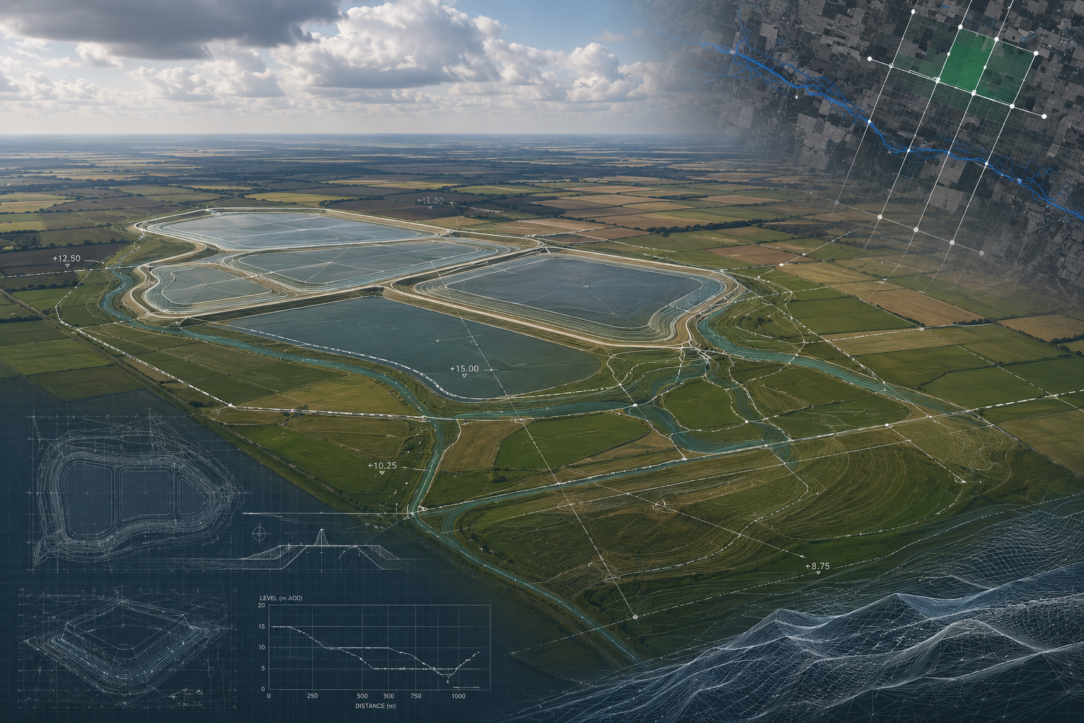
Fixed-wing UAV LiDAR and photogrammetry for Anglian Water's Lincs and Fens Reservoir DCO submissions — 70km² across two NSIP reservoir sites.
View Case Study →
Pre-planning topographic survey of a 250ha solar PV and 100MW/200MWh BESS site in Lincolnshire — DCO-grade outputs for planning, drainage and grid connection.
View Case Study →
Live weekly UAV earthworks monitoring on UK Critical National Infrastructure sites — 320–700ha sites, 24-hour cut-and-fill volume reporting.
View Case Study →