Expert Survey Solutions that deliver.
Expert Survey Solutions that deliver.

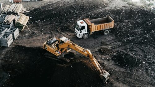
Earth Observation and Aerial Surveys Angell Surveys is at the forefront of Earth observation and aerial survey techniques, offering comprehensive data capture and analysis services. Earth observation and aerial surveys have revolutionised our understanding of the Earth’s surface by capturing, storing, and processing reflected and emitted radiation. Utilising techniques such as aerial photography, LiDAR, hyperspectral […]
Angell Surveys is at the forefront of Earth observation and aerial survey techniques, offering comprehensive data capture and analysis services. Earth observation and aerial surveys have revolutionised our understanding of the Earth’s surface by capturing, storing, and processing reflected and emitted radiation.
Utilising techniques such as aerial photography, LiDAR, hyperspectral and multispectral imaging, thermal imaging, and synthetic aperture radar (SAR). These surveys provide invaluable data for a wide range of applications.
At Angell Surveys we capture diverse types of data to meet clients’ specific requirements. Our expertise extends to various techniques, including aerial photography, LiDAR, sensing in the non-visible part of the electromagnetic spectrum, and Earth observation. We utilise aerial photography to capture high-resolution images from an aerial vantage point, offering valuable insights into land, buildings, and other structures.
LiDAR, or Light Detection and Ranging, utilises laser technology to measure distances and create detailed 3D models of the Earth’s surface. Sensing techniques in the non-visible part of the electromagnetic spectrum, such as hyperspectral and thermal imagery. Provide valuable information about the physical, chemical, and biological systems of the Earth. Earth observation combines remote sensing technologies with surveying techniques to capture, analyse, and present data on various aspects of the Earth’s systems.
We understand the critical importance of accuracy in survey measurements. Spatial measurement accuracy is used to quantify the possible difference between the actual dimension, size, relative position, or location and the measured value. By employing rigorous calibration, verification, and measurement processes, we ensure high accuracy levels in our data collection.
Additionally, we adhere to industry standards and guidelines to minimise errors and deliver reliable survey results. Resolution, expressed as Ground-sampled Distance (GSD), refers to the distance between the center’s of two consecutive pixels on the ground. We achieve high-resolution imagery and data to provide clients with detailed and precise information for their projects.
We understand that clients require comprehensive deliverables to support their decision-making and planning processes. They provide a range of final deliverables, including high-resolution aerial imagery, 3D models, topographic maps, and survey reports. These deliverables are tailored to meet clients’ specific needs and help them gain a comprehensive understanding of the surveyed area. The survey reports include metadata and essential information to validate the survey, ensuring its usability for future projects.
Before initiating a survey project, we consider various pre-project factors, such as data capture platforms and planning requirements. They assess the best data capture method based on project specifications, terrain, and client preferences. By understanding clients’ objectives, we tailor our approach to ensure optimal results. We also closely analyse any emerging developments in Earth observation and aerial survey techniques. We continually explore advancements in technology, such as improved sensor capabilities and data analysis methods, to enhance our services and provide clients with the latest and most accurate information.
Earth observation and aerial surveys employ a variety of cutting-edge techniques and platforms. Aerial photography captures high-resolution images from an elevated perspective, while LiDAR utilises laser technology to measure distances and create detailed 3D models. Hyperspectral, multispectral, thermal, and SAR imaging systems operate across different parts of the electromagnetic spectrum. Capturing valuable data on land cover, climate change, and more. These survey instruments are deployed on satellites, fixed-wing aircraft, helicopters, and unmanned aerial vehicles (UAVs), allowing for flexible and comprehensive data collection.
The data obtained through Earth observation and aerial surveys holds immense value in numerous fields and applications. National and cadastral mapping benefit from detailed and up-to-date spatial information, aiding in land management, urban planning, and infrastructure development. The design and construction of transportation infrastructure, including roads, railways, and airports, rely on accurate survey data to optimise routes and ensure efficient project execution. Engineering asset management benefits from continuous monitoring and assessment of critical infrastructure, ensuring safety and longevity.
Furthermore, Earth observation and aerial surveys support environmental monitoring and conservation efforts. By mapping land cover, identifying flood zones, measuring erosion, and modelling riverine and shallow-water bathymetry. These surveys contribute to effective land and water resource management. Additionally, they assist in navigation, 3D city modelling, heritage recording, and archaeological landscape analysis. Preserving our cultural heritage and enhancing urban planning processes.
Organisations recognise the power of geospatial data obtained through Earth observation and aerial surveys in providing insights into our natural and built environments. By harnessing this data, we can better manage and conserve our resources, leading to a more sustainable future. The information gathered supports climate change research, aids in the development of smart cities. It also contributes to the creation of digital twins that enhance the efficiency of the construction and infrastructure sectors. The integration of geospatial data into decision-making processes empowers us to make informed choices that positively impact our planet.
Earth observation and aerial surveys have transformed the way we perceive and manage our environment. Through advanced techniques and platforms, they provide essential data for a wide range of applications, from national mapping to infrastructure development and environmental monitoring. The valuable insights gained from these surveys enable us to better understand our world and contribute to a more sustainable future. By embracing the power of geospatial data, we can make informed decisions that positively impact our natural and built environments, paving the way for a brighter tomorrow.
At Angell Surveys we combine our expertise in Earth observation and aerial survey techniques to provide clients with comprehensive and accurate data. By employing various data capture platforms, including aerial photography, LiDAR, and non-visible spectrum sensing. We offer a wide range of survey detail and deliverables. Our commitment to accuracy, resolution, and adherence to industry standards ensures reliable and precise results. As technology evolves, we aim to remain at the forefront, exploring new developments and continuously improving our services.
Trust Angell Surveys for cutting-edge technology, expertise and timely delivery when it matters.