Expert Survey Solutions that deliver.
Expert Survey Solutions that deliver.
A bathymetric survey is a hydrographic survey that measures and maps the depths and shapes of underwater areas, giving you accurate details about what lies beneath lakes, rivers and oceans. It is essentially an underwater version of a topographic survey. This kind of underwater mapping is important for understanding water depth, tracking changes in the […]
A bathymetric survey is a hydrographic survey that measures and maps the depths and shapes of underwater areas, giving you accurate details about what lies beneath lakes, rivers and oceans. It is essentially an underwater version of a topographic survey.
This kind of underwater mapping is important for understanding water depth, tracking changes in the seafloor and assessing flood risk.
If you plan any work near water, knowing the exact underwater landscape can prevent costly mistakes and improve safety. Bathymetric surveys also play a key role in environmental studies and help monitor any shifts in the natural terrain.
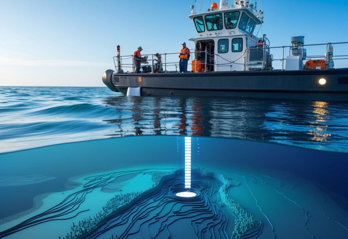
Bathymetric surveys allow you to map the underwater landscape, giving exact depth and shape details of riverbeds, lakes and sea floors. Using specialised equipment and data processing, you gain information that supports safe navigation, engineering, environmental work and construction.
There are several main methods used for bathymetric surveys. Traditional surveys involve lowering a lead line over a boat’s side to measure depth, but this technique is mostly historical.
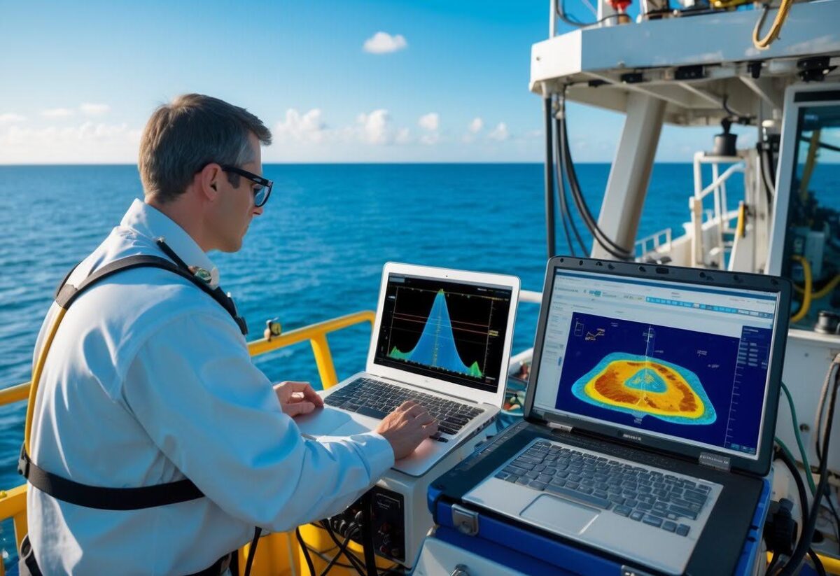
Today, surveyors use sonar technology such as the echo sounder. These systems send sound waves to the bottom and measure how long it takes for the echo to return, letting you determine depth at many points very quickly. Leading surveyors like Angell Surveys are using drones with echo sounder capabilities as a fast and cost-effective way to carry out bathymetric surveys.
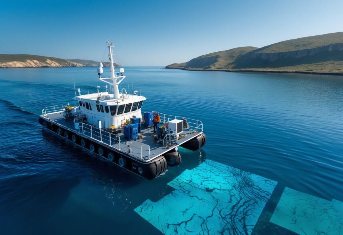
Multibeam surveys can create detailed 3D maps of the underwater surface. Satellite-derived bathymetry uses satellite images to estimate water depth in clear, shallow areas but is less accurate than sonar methods. Techniques are chosen based on location, water depth and your needed accuracy. For mapping in shallow waters where boats cannot safely go, remote-controlled or robotic drone survey vessels should be used.
You will use key tools to conduct these surveys. The echo sounder is a central instrument. It provides high-resolution data for producing a digital terrain model of the underwater surface.
Most surveys are done using a survey vessel, which carries this equipment along planned lines across the water body. Drones can take the manual work out of carrying out bathymetric surveys, with no need to venture into the waters.
Adaptive surveys use advanced technology to adjust data collection depending on water and seabed conditions. Tide hydro data is also gathered at the same time to correct depths for changing water levels.
After collecting survey data, you need to process it carefully before it is used. Raw data from the echo sounder or multibeam system may contain noise and errors.
You will first filter out incorrect or suspicious readings. Tide hydro data is applied to adjust for fluctuations in water level, making sure each depth point is referenced to a fixed baseline. Then, you can use software to combine all corrected depth points to create a digital terrain model, which is a detailed representation of the underwater terrain.

Processed data is used for maps, construction planning, navigation and environmental studies. Advanced software helps visualise and analyse the results, allowing you to spot hazards, measure sediment volume or design underwater structures.
Bathymetric surveys play an important role in modern water management, navigation, infrastructure and environmental studies. These surveys measure the depth and shape of underwater surfaces, enabling better decisions for your projects and safety.
Bathymetric data is essential when you need to monitor reservoirs, lakes and rivers. It helps you calculate volumes of water bodies, track sediment build-up and plan water security measures. This can be especially important during flood assessments, as understanding the underwater topography allows authorities to identify high-risk zones.
Operational water boards rely on bathymetric maps to guide water resource planning and allocations. Knowing the bottom profile is fundamental for predicting how a water’s surface or volume will change due to rainfall, drought or sediment deposition.
Bathymetric surveys also aid in precise volumetric calculations. You can use this data to maintain reservoirs, anticipate flooding risks and manage overall water supplies more effectively.
Safe navigation for ships and boats depends on accurate maps of the sea, river or lake beds. Bathymetric surveys provide you with detailed information about underwater features, including depth variations, slopes and hidden hazards.
These surveys support hydrographic organisations and maritime authorities by refining nautical charts and planning safe shipping routes. Proper mapping is important for ports, ferry crossings and busy shipping lanes.
Survey results help reduce the risk of vessel groundings or collisions with underwater objects. If you rely on the maritime industry, routine bathymetric updates are necessary for both daily operations and emergency responses.
Before constructing bridges, piers or flood defences, knowing the underwater conditions is vital. Bathymetric surveys give you a clear understanding of the submerged terrain and bottom profile, preventing unexpected delays or costly mistakes during construction.
These surveys also guide infrastructure repairs and ongoing maintenance. Land development projects near water bodies can benefit from integrating bathymetric data with topographic surveys, allowing for safer and more efficient designs.
In addition to new developments, bathymetry supports dredging activities and sediment management. Real-world measurements ensure your construction plans are based on up-to-date and accurate information.
Environmental monitoring relies on detailed bathymetric data to study aquatic habitats, erosion patterns and pollutant movement. You can use these maps to assess condition changes over time, such as the effects of climate events or human activity.
Hydrodynamical modelling incorporates bathymetric surveys to simulate water flow, wave action and sediment transport. This is key for predicting flood events, planning habitat restoration and designing coastal protections.
Wildlife agencies, researchers and environmental engineers depend on accurate underwater mapping for conservation planning. The results support better decision-making for both short-term projects and long-term ecological health.
The speed and accuracy of bathymetric surveys has improved as tactics have become more advanced. We’ve moved on from the days of lowering lead lines to measure depth into more sophisticated technology that includes echo sounders and GPS. Often, this would still involve taking to the waters in a ship, which posed safety risks and could quickly become costly.
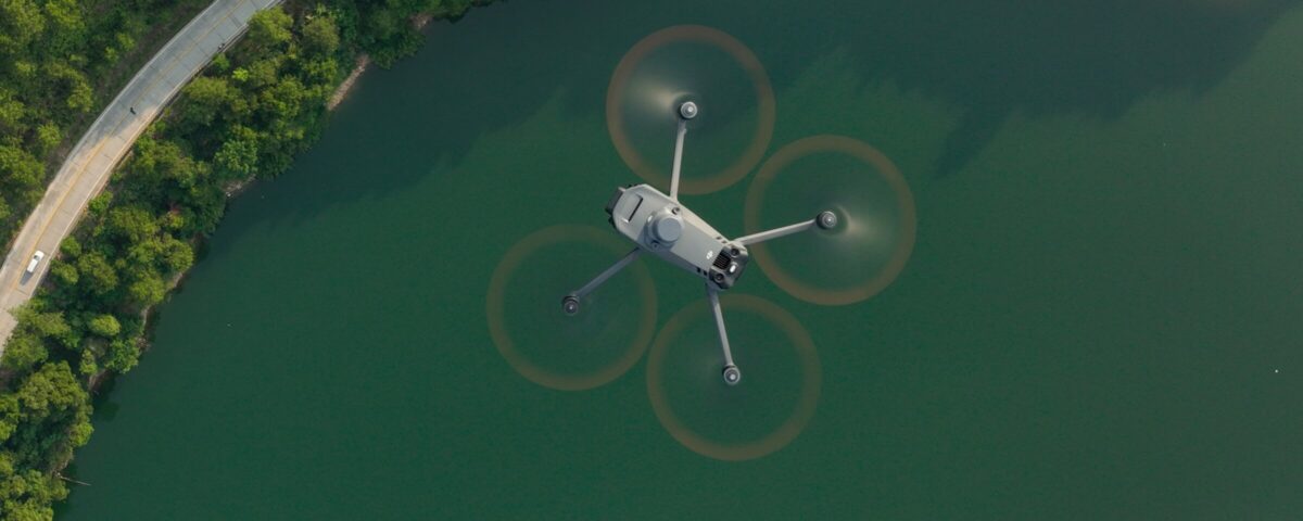
Now, drones are offering the most cost-effective, safe and efficient method of carrying out bathymetric surveys. With the ability to remotely control drones or input a pre-set flight path, we can reduce the risks and costs associated with manual surveying.
By using the most sophisticated drone technology available, we guarantee highly accurate results and data output that works with all your relevant software systems. To cut costs, protect staff and save time, Angell Survey’s drone bathymetric surveys are the solution.
Bathymetric surveys use technology to map and measure underwater landforms. These surveys rely on special tools and precise methods to ensure reliable underwater data.
You conduct bathymetric surveys by sending sound waves from a device, usually attached to a boat, down into the water. The time it takes for the sound waves to return helps you calculate the water’s depth at various points.
Traditional methods involve boats moving along planned paths to cover the area being mapped. You often use GPS systems to track the boat’s exact location for accurate measurement. Drones are becoming more widespread in bathymetric surveys, offering enhanced speed, cost efficiency and safety.
The main instruments include echo sounders, sonar systems and GPS devices. Multi-beam echo sounders and single-beam echo sounders are the most common for measuring depth.
You also need a GPS to record the exact position for each measurement. Data recorders and computers process and store the collected information. These can all be embedded into equipment on a boat or drones.
A hydrographic survey maps both underwater and coastal features like shorelines, rocks and wrecks. Bathymetric surveys focus only on mapping the shape and depth of the underwater terrain, such as the riverbed or seafloor.
Hydrographic surveys often include bathymetric methods, but are broader in scope.
A standard report usually includes maps of underwater landforms, detailed depth measurements and data tables. The report may also contain 3D images, cross-sections and notes about the methods and equipment used.
You receive digital files for further analysis and printed charts that help explain the survey findings. These bathymetric survey reports help guide planning and construction projects involving water bodies.
Companies specialise by investing in advanced equipment, training skilled staff and staying updated on the latest survey methods. They often focus on specific types of environments, such as rivers, lakes or coastal areas.Bathymetric surveys form part of our wide drone survey offering at Angell Surveys. With RICS-accredited surveyors and the latest in drone technology, you’ll receive a fast, cost-effective survey that leaves no stone unturned. Enquire about our surveys now.
Trust Angell Surveys for cutting-edge technology, expertise and timely delivery when it matters.