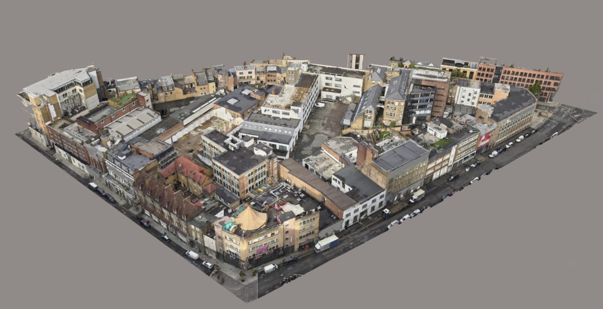
Architectural and Heritage Conservation
Our drones capture detailed images of historic sites and buildings, aiding in preservation efforts and enabling accurate restorations.
Expert Survey Solutions that deliver.
Unlock the power of precision with our state-of-the-art reality capture drone services. From intricate 3D models to detailed topographic surveys, our advanced technology and expertise bring your project’s details to life. Discover the potential of accurate, efficient, and comprehensive aerial data capture.
Reality capture services are redefining precision and insight in surveying and modelling. By harnessing advanced photogrammetry and aerial LiDAR technology, we transform unordered photographs and laser scans into highly detailed 3D models. Our approach caters to a myriad of applications, from architectural heritage preservation to urban planning and infrastructure development. Experience the future of surveying with our commitment to quality, backed by the latest in drone technology and software solutions. Discover how our reality capture can bring unparalleled clarity and accuracy to your projects.

At Angell Surveys, we leverage the pinnacle of aerial imaging and scanning technology to deliver superior reality capture services:
This advanced suite of technology, combined with our expert team’s proficiency, positions Angell Surveys at the forefront of the reality capture field, offering data that is not just accurate but truly transformative for your projects.
The advantages of employing reality capture drone services are transformative, offering a new level of precision and efficiency in data collection. Key benefits include:
These benefits underscore why reality capture drone services from Angell Surveys are indispensable for modern, data-driven project planning and execution.
We combine processed aerial data with ground-based laser scans and produce a single model from which various deliverables are produced, including CAD drawings, ortho-facades and 3D solid models.
Our approach ensures better data input leads to superior outputs, empowering our clients with accurate and detailed information for efficient asset management and infrastructure planning.
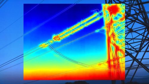
Reality capture is a groundbreaking technology that combines photogrammetry and laser scanning to produce three-dimensional models from aerial data. This process involves capturing thousands of high-resolution images and laser scans, which are then intricately processed to create detailed point clouds and 3D models.
At the heart of our service is the use of sophisticated software, such as Bentley ContextCapture, which enables us to achieve extraordinary detail and precision in our models. Whether for mapping vast landscapes or conducting detailed architectural surveys, reality capture offers an efficient and accurate solution.
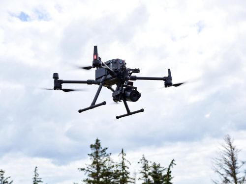
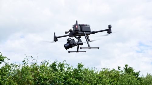
Our Sony A7RMk4 61MP camera system, mounted on state-of-the-art drones, ensures that every nuance of the surveyed area is captured, providing our clients with data that is not only precise but also incredibly detailed, enabling intelligent decision-making across various project phases.
The process of reality capture at Angell Surveys is distinguished by meticulous planning and execution, ensuring the highest quality of data for our clients. Here’s an overview of our comprehensive approach:
This structured process, combining state-of-the-art technology with our surveying expertise, ensures that every reality capture project delivers actionable insights and precise outcomes.
Choosing Angell Surveys for your reality capture needs ensures you benefit from unparalleled expertise and cutting-edge technology. Here’s why we stand out in the field:
Angell Surveys is your trusted partner in transforming complex environments into detailed, accurate digital representations, driving forward your projects with confidence.
The versatility of drone-based reality capture services by Angell Surveys is evident in its broad spectrum of applications across various sectors. Each of these applications demonstrates the transformative potential of reality capture in improving efficiency, accuracy, and safety in project planning and execution.

Our drones capture detailed images of historic sites and buildings, aiding in preservation efforts and enabling accurate restorations.
Contractors and engineers utilise our 3D models for planning, monitoring construction progress, and ensuring projects adhere to their blueprints.
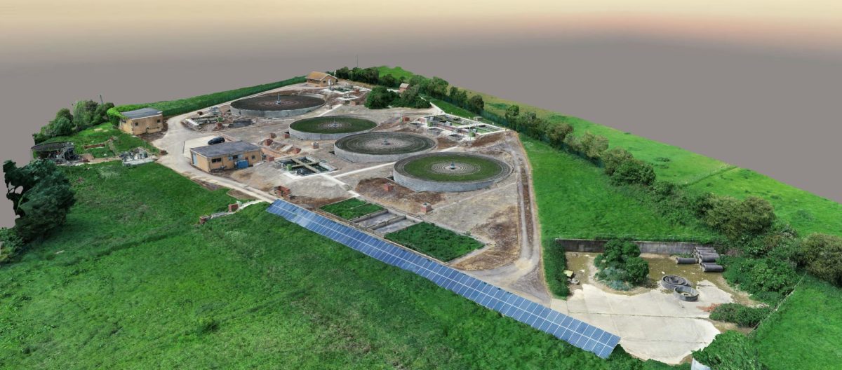
We provide essential data for environmental studies, land use planning, and resource management, helping to monitor changes in ecosystems and manage natural resources effectively.
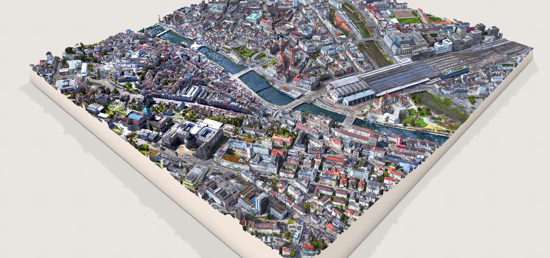
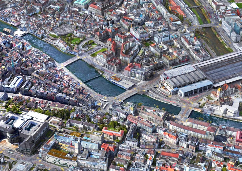
Municipalities and urban planners rely on our detailed topographic maps and 3D models for city development, infrastructure improvements, and disaster management planning.


“Our commitment to harnessing the latest in drone technology and photogrammetry ensures that your projects are not just seen, but truly understood in unparalleled detail. From comprehensive 3D models to detailed topographic mapping, we transform your vision into a tangible asset for informed decision-making and strategic planning.”
Embark on a journey of discovery and precision with Angell Surveys' reality capture services. Don't let complexity hold your project back. Reach out to Angell Surveys today to learn how our reality capture solutions can elevate your project's potential. Let's capture reality together.