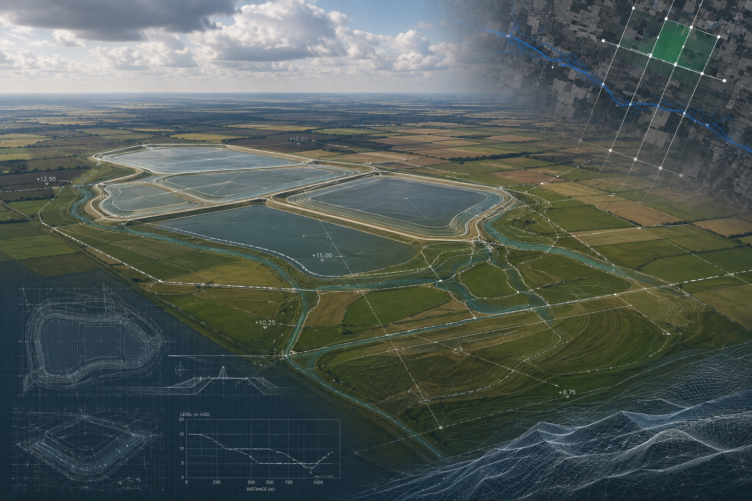
Anglian Water — Lincs & Fens Reservoirs Aerial Survey (LiDAR & Photogrammetry)
Fixed-wing UAV LiDAR and photogrammetry for Anglian Water's Lincs and Fens Reservoir DCO submissions — 70km² across two NSIP reservoir sites.
A selection of projects completed by the Angell Surveys team — covering rail, nuclear, renewables, built environment and utilities across the UK.
Fixed-wing UAV LiDAR and photogrammetry for Anglian Water's Lincs and Fens Reservoir DCO submissions — 70km² across two NSIP reservoir sites.
Pre-planning topographic survey of a 250ha solar PV and 100MW/200MWh BESS site in Lincolnshire — DCO-grade outputs for planning, drainage and grid connection.
Live weekly UAV earthworks monitoring on UK Critical National Infrastructure sites — 320–700ha sites, 24-hour cut-and-fill volume reporting.
Measured facade survey of the former Arsenal stadium at Highbury Square, Islington — DWG and Revit 2022 deliverables georeferenced to OS National Grid.
Drone reconnaissance survey of ten 12–42 m deep manholes on a Thames Water sewer in Chalfont St Peter — XYZ positions, geometry, depth and condition data to plan a follow-on physical inspection of the 675 mm connecting sewer.
Fixed-wing UAV LiDAR and photogrammetry survey of the Calair Burn catchment near Balquhidder for the Forth Rivers Trust — sub-50cm DTM supporting the Ballimore Restoration flood risk assessment.
Most scoping responses sent within one business day.
RICS-regulated work, led by Philip M. Angell MRICS.